the Spungone
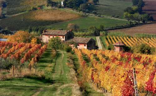
The Spungone, from the dialect spugnò or spungò for its “spongy” aspect, is a particular type of calcareous sandstone rock that shapes the surrounding hills and that influences the geology of the territory and the local agriculture, in particular the wine and oil production.
The Spungone is made up of a coarse mixture of seashells held together by a calcareous cement. It originates from marine deposits (of a relatively low sea) settled during the Middle Pliocene, about 3 million years ago, on raised areas that constituted the Romagna of that time.
Currently the Spungone forms a sort of rocky ridge that makes up the hills. The most evident outcrops can be observed in the points where the hills are crossed by the course of the rivers, and especially by the Montone river near Castrocaro (the same fortress is built on the Spungone), at the summit of the Bertinoro hill (under the fortress) , on the Rabbi river near Fiumana, and on the Bidente-Ronco river near Meldola.
The Spungone Raw material
The Spungone has been used for centuries as a construction material for bridges and houses because of the easy availability and malleability of this sponge rock, but also to make millstones and as a raw material for manufacturing, after being baked in special ovens.
The Spungone Notes on the geology of the Romagna “spungone”.
A cura di Marco Gualdrini
The territory of central Romagna is characterised by the presence, in outcrops scattered in a strip of about thirty km, of a particular type of yellowish rock, with a coarse texture, which is hard but also easily crumbling, because it is pitted and full of "caries" and holes, characterised by the presence of fossils easily identifiable with the naked eye, in particular of shell fragments.
Its characteristic appearance may recall that of a sponge, and this probably gave rise to the local name of“spungone”. Its relative softness makes it easily workable and historically it has been used locally as a building material: it is not uncommon to find sections of spungone in the walls of rural houses and also in the buildings of the neighbouring towns.
Its outcrops discontinuously dot a strip in the first hills that goes from Faenza to Cesena, particularly affecting the territory of the municipalities of Castrocaro, Meldola, Predappio and Bertinoro: in these areas the rock creates more or less marked reliefs and hillsides, on which anthropogenic constructions have often been built, such as the Rocca of Castrocaro, that of Meldola and the town of Bertinoro itself.
It is a peculiar kind of rock because, as previously mentioned, it has a coarse texture consisting mainly of fragments of fossils: shells and also chopped mash of organogenic origin; its chemical nature is essentially calcareous, carbonatic, because calcium carbonate is the main component of the fossils that compose it, which means that where the outcrops emerge the soil takes on particular characteristics, i.e it is more fertile and suitable for the settlement of shrubby and arboreal vegetation, and also suitable for the cultivation of some vines, in particular.
What is the origin of this rock and why do we find it specifically in this area? To find it out, we need to understand the geology of the Romagna Apennines.
The sedimentary rocks of the Romagna Apennines.
While to the north of the via Emilia the Romagna area is essentially flat, the hinterland, south of the via Emilia, is characterised by a gradual but rather continuous development of hilly reliefs, at first very gentle and rounded and then, as one proceeds south towards the Apennines ridge, more marked, with clearer and more prominent shapes. Thus, we start from the very low altitudes of the areas of the plains (a few tens of metres above the sea level) up to over a thousand metres of the mountain ranges of the Casentinesi Forests (Foreste Casentinesi).
The rocks that make up these mountain ranges are sedimentary rocks: rocks, that is, made up of sediments, or fragments, granules - of various sizes - derived from other more ancient rocks, eroded by atmospheric agents or by the action of meteoric and marine waters, which have been accumulated over the millennia and, over time, have "cemented" (a process called diagenesis) to form the rock formations that we can observe today.
For geologists, sedimentary rocks take various names, based on the size of the granules that constitute them, from coarse to fine, observable with the naked eye or with a magnifying glass or microscope. Thus, we have conglomerates, consisting of pebbles, gravel and crushed stone with granules from tens of centimetres up to 2 mm; sandstones, consisting mainly of cemented sands, with granules from 2 mm (coarse sand) to 1/16 of a millimetre (fine sands),siltstones or silts, with very small granules, from 1/16 of mm up to 1/256 of mm, and clays, formed by accumulations of microscopic granules, smaller than 1/256 of mm.
All these rocks are therefore formed by the deposition and accumulation of these sediments and this formation process occurs in the vast majority of cases by means of water, which first erodes the oldest rocks, crushes them, then transports them and finally makes them deposit. This is a phenomenon that has occurred on the surface of the Earth for millions and millions of years, and which continues to the very day, incessantly, from minor waterways to rivers and the sea.
The fact that sandstones, conglomerates or clays are deposited essentially depends on theenergy that the water had when it allowed to deposit those particular sediments. It is easy to understand how the largest and heaviest granules, the pebbles, can be transported only where the water has a great energy, therefore generally along the courses of the most impetuous rivers, at the foot of the mountains, or in coastal environments or sea cliffs, where the waves break with great force. Smaller and lighter sediments are transported farther forwards and settle where the water has less force: sands, for example, settle on the edges of medium-energy rivers, on shallow beaches or in the shallow seabed, where a certain force of the water is still present, which is given by the current or by the waves, but that is not so strong as to keep these grains in suspension. The clay granules, which are the smallest and lightest, are the last to settle, because even a very weak and light movement of the water is enough to bring them back into suspension: clays thus settle in very calm bottoms, away from currents and the movements of the waves, and therefore, generally, in the depths of the deep seas.
If we observe the rocks that make up the hillsides of central Romagna, we will discover that in the strip closest to the plains, they are mainly made up of clays, and the hills have gentle and soft shapes, given by the plasticity and easy erodibility of this rock, which as is well known, can easily soak up water and become plastic and tender. In this first band, however, due to the same ease of the clay in losing hardness, in being eroded and in collapsing, sometimes the gentle hillsides are interrupted by the characteristic phenomenon of the "ravines": barren areas, devoid of vegetation, characterised by unstable sharp ridges, tending to collapse, interspersed with a network of gullies within which the clay crumbles.
Moving towards the south, towards the Apennines ridge, instead, we find rocks that tend to be harder, with more massive and steep mountain ridges, mainly consisting of an alternating sequence of stratifications of sandstone and marlstone (a type of clay with a strong calcareous component), which is easily identifiable in the eroded rocky faces near the rivers. These stratified rocks are structured in "packs" of considerable thickness, which emerge for several hundreds of metres but continue underground for an overall thickness that in some points reaches two or three km. Given that the phenomenon of sediment deposition and consolidation is a phenomenon that occurs very slowly, we can understand how all this thick rock has been deposited over a very long period of time, of many millions of years.
This means that, for a very long period of time, in what is now the territory of central Romagna there was a sea of varying depth depending on the phases. This is not to say that the sea level was higher than its current altitude, but rather that the land that then made up the seabed was lower than today, and that, at some point, something happened that led the seabed to rise up to emerge from the sea and become proper land, a continental environment.
Tectonic genesis of the Apennines.
The phenomenon that led the seabed to rise, certainly not always in the same way, but with periods of advancement and others of retreat, also depending on the area, is another fundamental phenomenon that underlies the geological structure of the Romagna area, and which still continues today: the orogeny of the Appennines, that is, the formation of the Apennines chain due to the tectonic thrust of the colliding plates.
It is known that Italy owes its geological structure to the meeting, or rather the collision, of two tectonic plates, the African plate (or more precisely an offshoot of it, the Adriaplate) and the European continent. The Adria plate presented a movement in a first long phase (from 60 to 30 million years ago) mainly directed from south to north, generating the chain of the Alps in the collision with the European plate; in a second and subsequent phase, starting about 20 million years ago, the movement of the plates, which was blocked by the presence north of the Alps, became more complex, with a prevalent component from south-west to north-east: the chain of the Apennines therefore began to form in a longitudinal direction, with an axis from north-west to south-east.
The Apennines thus formed - and grew - due to the compression of the plates, proceeding from the western part of Italy in formation towards the eastern part, more or less where Romagna and the Marche region are now, where there was an ancient “palaeo-Adriatic” sea, more or less deep depending on the points and times, within which turbid flows of sand and clay were deposited (Miocene, from 20 to 5 million years ago), which were given by large submarine landslides at the eastern margin of the Apennines chain in formation, followed then (Pliocene, from 5 to 2 million years ago) by quieter phases of deep sea in which clay was deposited. The movement progressed from west to east, and this movement continues today, towards the Adriatic Sea.
The tectonic thrusts continued generating, in very slow and long times, deformations and folds in the rocks in the process of consolidation, but also fractures, faults, lines of discontinuity between strips of rock that split, with relative movements, both vertically and horizontally. The faults and tectonic lineations determined the trend of the folds and subsequent structures later characterising the Apennines chain, even on a large scale.
On a smaller scale, more specifically in the central Romagna area, these discontinuities have had local effects, generating differentiated areas, with submarine reliefs that led some areas to be, for some periods, raised with respect to the surrounding areas. In these areas, which were active for rather limited time intervals - on a geological scale - different rocks from the surrounding clays were deposited, because the sedimentary formation environment was different.
On the fragmented and discontinuous structural reliefs, the shallow sea allowed the deposition of coarser sediments and also of cliffs rich in organisms with calcareous shells, such as molluscs, bryozoans, rhodophytic algae and foraminifera; in the areas adjacent to these cliffs, as a result of fracturing and tectonic segmentations, submarine channels were created in which the sediments deriving from the dismantling of the cliffs gradually accumulated, creating coarse deposits of sandstone of organogenic origin, consisting of fragments of the shells of organisms present in the neighbouring areas of the low seas. Subsequent vertical tectonic movements (characterised by “slumps”, i.e. landslides in the sediments in the phase of accumulation and consolidation) thus produced the lowering of these reliefs, with various settling phases that ended by bringing the sedimentary deposition environment back to that of the deep sea. The clayey deposits then overlapped the calcarenitic ones, blending into one another or intersecting with the previous ones.
The last phase of the orogeny saw a new and general deepening of the sea with the deposition of the last layers of clay, which was then followed by the progression towards the east of the elevation of the Apennines chain, with the definitive emergence of the lands of Romagna (in the Pleistocene , from 1.8 million years ago) and the beginning of the formation of the Po valley (of alluvial or fluvial origin).
The "spungone" of the Romagna Pliocene.
In the area between Faenza and Cesena, within the range of Clays, in the rocks corresponding to the period of the Lower - Middle Pliocene (from 4.5 to 3.5 million years ago), we therefore identify a sort of "chain" or "vein ”, consisting of outcrops and markedly discontinuous edges but capable of forming significant mountain ridges, such as Monte Torre, Castellaccio, Colle delle Caminate, Monte Palareto, Monte Casale, Monte Maggio of Bertinoro and Monte dei Cappuccini.
They appear as outcrops of a stratified rock of a gray to yellowish colouring, very rich in fossils, whole or more often in fragments, in particular of shells, which give it acharacteristic structure that is often not very compact and rather rich in cavities, cariatures, alveoli, holes (from which probably the dialectal name “spungò” derives, due to the spongy appearance).
It is the Romagna “spungone”, made up of rocks that are harder and more massive than the surrounding clays, and which therefore emerge from the neighbouring areas. In fact, it mainly consists of an “organogenic calcarenite”, i.e. a sandstone with a strong calcareous component, given by the cementation of fragments of hard parts of marine organisms that lived in the reef environments described above, in correspondence with the structural reliefs, which formed in defined discontinuous bands from tectonic discontinuities in the palaeo-Adriatic sea mentioned above.
It is its discontinuous and fragmented nature proper, with limits that are sometimes fleeting and masked by the present vegetation (that forms here for the more fertile substrate than the surrounding clays), that determines the "spungone" to be identified, at a historical-cultural level, more as a "rock" or building material than as a geological formation or "chain" (in the maps it is never indicated as a geographical element, unlike, for example, the neighbouring Chalk Vein - Vena del Gesso - of the Brisighella area, while the various hillsides that are made of "spungone" are highlighted in the maps).
From a more strictly geological point of view, as we have already seen, the fragmentary nature of the “spungone” tells of a rather complex origin of this formation, which is also witnessed by the diversity of characteristics (facies) with which the spungone appears, depending on the area.
Cremonini and co-workers (Cremonini et al., 1982) identify three lithological associations, which are described as follows:
- association A (bioconstructed organogenic limestones, rich in foraminifera of the genus Amphistegina, lamellibranchs, rhodophytic algae, colonies of bryozoans in a position of physiological growth, forming "cliffs" of low sea and/or of coastal environment);
- association B (organogenic calcarenites composed of debris deriving from association A, resettled in shallow sea canals);
- association C (olistolites, blocks belonging to the previous disarticulated lithofacies and included in sediments of a later age).
A dependence of the deposits of association B from those of association A is identified in this subdivision, where the latter are identified as the source rock of the former.
In the distribution area of the spungone outcrops the facies are present in different percentages: in the westernmost area, from Castrocaro to the Faenza area, the most widespread facies is association B, i.e. the re-sedimented organogenic calcarenite, while in the Bertinoro area facies A is the one most prevalently present, consisting of a real bioconstructed organogenic limestone, therefore a proper “fossil reef in place” made up of bryozoans, rhodophytic algae (a type of algae that produce calcareous concretions) and lamellibranch molluscs (such as various types of combs - including scallops - and oysters). Facies C where the spungone blocks have a much more chaotic and remodelled nature, and a displacement even within more recent sediments, confirms the complex genesis of these deposits, which are influenced in their formation by syn-sedimentary tectonic phenomena (i.e. contemporary to the sedimentation), such as submarine landslides (slumps) and fault effects.
The scarce lateral extension of these deposits derives from their geometric shape: instead of being large deposits of tabular shape, extended laterally (such as the oldest sandstones of the Marlstone-Sandstone Formation or the large deposits of the Blue Clays), these deposits were formed on circumscribed areas with a raised seabed on which cliffs of rhodophytic algae and lamellibranchs were established (an image that brings to mind today's sub-tropical environments) or in various submarine gullies of limited extension and depth, in which the sands coming from the low sea areas often collapsed, promoted by small earthquakes or by the movements of the faults present there. The deposits therefore take on a "lenticular" shape, which laterally fades into the surrounding clayey deposits.
Surely the environment of formation of the spungone was rather "disturbed" and "dynamic", very different from the calm deep sea in which the clays sedimented!
The fossils of the spungone.
Many palaeontological studies have been conducted on the rocks of the spungone.The most common and striking fossils are certainly the remains of lamellibranch molluscs, more specifically pectinids (scallops) and ostreids (similar to the current oyster). By true, the living species in these environments must have been many more than those actually found, but the fossilisation processes favoured organisms with harder shells and with shapes more suitable for conservation, while the skeletons of many other organisms were not preserved if not as "hollow" footprints. Moreover, the pitted appearance of the rock, as well as deriving from the effects of a differentiated erosion of the atmospheric agents, such as wind and meteoric water, can also be ascribed to the selective dissolution of the skeletons of some organisms, which left a series of holes and cavities in place of their bodies.
Other important components of the spungone are the rhodophytic algae, a type of red algae capable of producingconcretions of calcium carbonate, which constitute a sort of bone structure for the growth of the algae themselves. Likewise, colonies of bryozoans are also found, which consist of colonial organisms similar in external appearance to corals (but that are organically more complex): they too secrete a thin limestone skeleton, which produces encrustations on the surfaces of rocks or shells of other organisms on which the bryozoans could be anchored in order to proliferate.
The foraminifera of the genus Amphistegina should also be mentioned, which are unicellular organisms still present in the seas of the world, characterised by a lenticular-shaped calcareous shell, with a diameter of about 2 mm (more or less that of a large grain of sand): the spungone is very rich in these organisms.
All the fossil organisms mentioned, which are partly extinct, are characterised by a preference for a warm sea environment, which makes us think that the environment in which the spungone formed was of a sub-tropical type, like the Caribbean or similar.
The fossils and the sedimentological considerations described above therefore allow us to outline a rather characterised and articulated genesis for the spungone. If, in general, in the whole Romagna Apennines margin there is a prevalence of rocky deposits reflecting a calm and deep sea, characterised by the formation of clays, the environment of formation of the "spungone", characteristic of some intervals of the lower Pliocene at the limit with the medium Pliocene (between 5 and 3.5 million years ago), describes a localised belt characterised by shallow sea beds, with (high structural) reliefs of distinct tectonic origin compared to the vast neighbouring deep sea beds, characterised by warm waters and a high energy.
In this particular area, this condition allowed the establishment of organogenic reefs made up of different types of organisms and the simultaneous and consequent formation, in the gullies adjacent to these reliefs of the seabed, of reworked deposits of sand, and therefore of sandstones, of coastal organogenic origin, which then interspersed with the neighbouring deep sea clays.
This particular palaeo-environmental condition allowed the formation of these rocks, which are so peculiar and characterised, so rich in calcium carbonate and therefore also so suitable, once they emerged, for the establishment of more luxuriant forms of vegetation than the surrounding environment – (including the vines of the Albana DOC of Bertinoro).
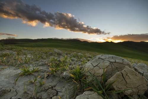
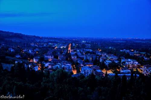
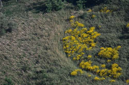
Gallery
Discover the postcard images taken on the Spungone in Romagna. You can also share them on social networks such as Twitter and Facebook.